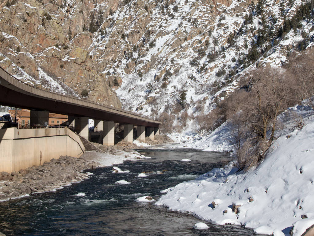
Glenwood Canyon was carved out by the Colorado River millions of years ago, and today it is the pathway for Interstate 70 as travelers exit the Rocky Mountains on the western side of Colorado. Anyone who has driven I-70 through CO will remember driving through Glenwood Canyon because the lengthy elevated roadways are uniquely amazing.
Today the canyon is best known for beautiful scenery, mudslides and incredibly disruptive closures.
Important Info
Glenwood Canyon may have frequent closures, even outside of the winter season. Recent wildfires killed vegetation that helped the soil stay in place along the sides of the canyon. Heavy rains now bring a high risk of mud slides.
It is a big deal when Glenwood Canyon closes. There is no quick alternate route. The main detour utilizes Highway 40 through Steamboat Springs to the North.
Heading westbound on I-70: exit at Silverthorne and head north on HWY 9 -> west on HWY 40 over Rabbit Ears Pass -> south on HWY 13.
CDOT asks that you don’t try to use any of the roads and mountain passes to the south of I-70 as a detour. The mountain roads may not be paved and there may not be any cell phone service on these roads.
Rest Areas
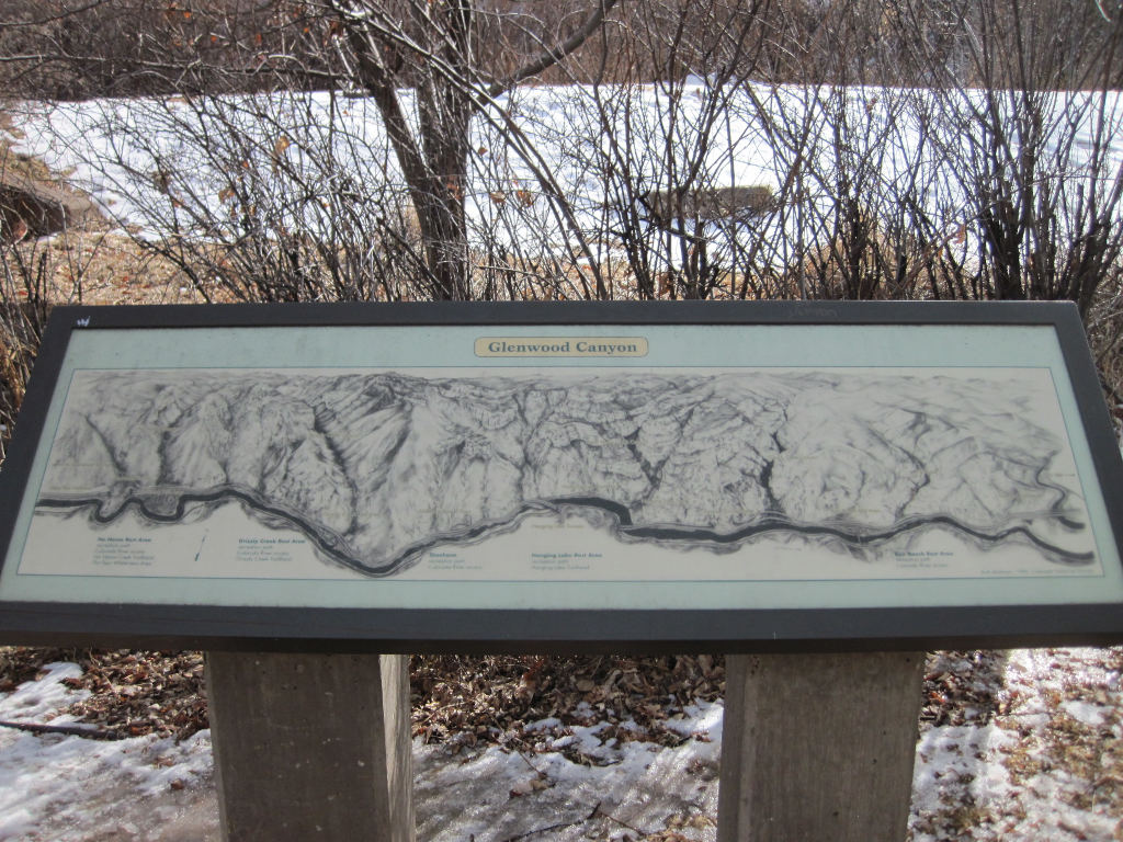
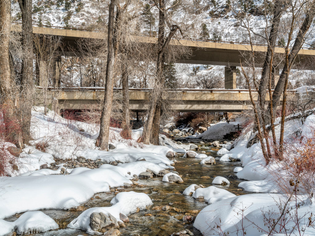
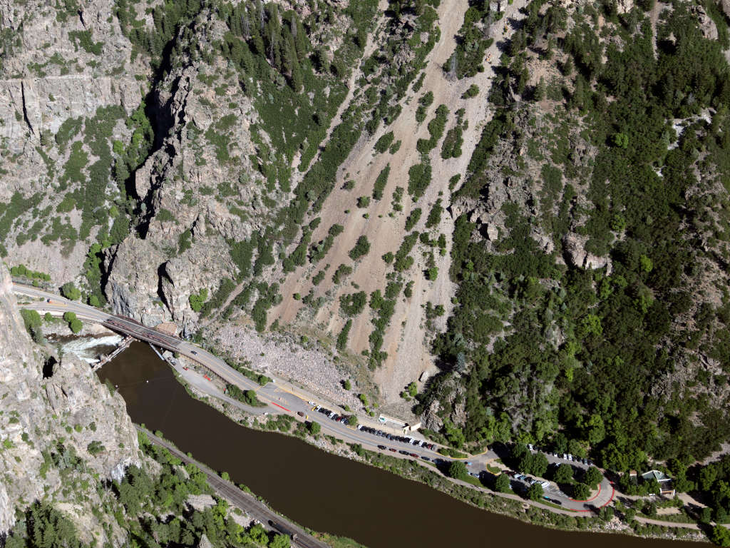
There are 4 rest areas in Glenwood Canyon. These include the Blair Ranch, Grizzly Creek, No Name, and Hanging Lake Rest Areas. All of these rest areas are located right alongside of the Colorado River within the canyon.
This map is found at all of the rest areas in the canyon
Grizzly Creek Rest Area
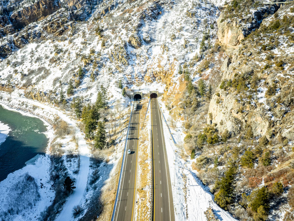
Tunnels
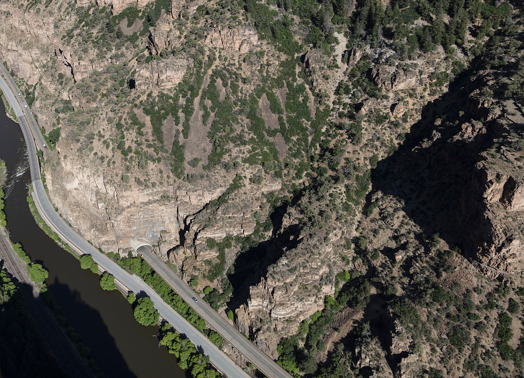
No Name Tunnel
Hanging Lake tunnel
Reverse Curve Tunnel
There are a total of 3 tunnels (with 5 total bores) in Glenwood Canyon. This includes the first two pairs named above that each have an eastbound tunnel and a westbound tunnel. The Reverse Curve Tunnel is located between mile marker 128 and 127, and it has a single bore for the westbound lanes only.
Reverse Curve Tunnel
Hanging Lake Traffic Control Center
This command center is built into the Hanging Lake tunnels. The center includes a monitoring station, fully equipped fire department and highway maintenance equipment. The center also functions as the Western Slope Colorado Transportation Management Center for CDOT.
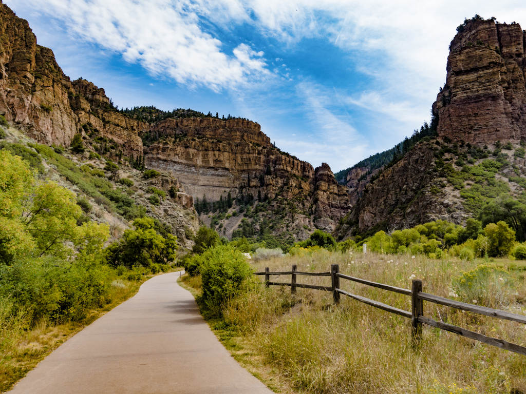
Exercise Path
Glenwood Canyon has an exercise path that runs the full length of the canyon. This was built as part of the initial construction of the interstate highway through here.
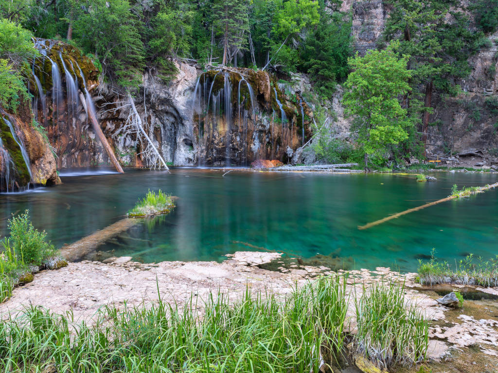
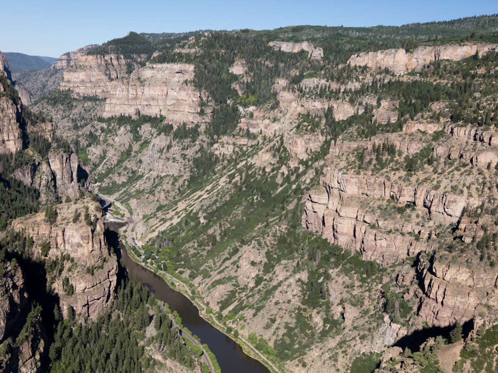
Hanging Lake
Use the Hanging Lake exit from I-70 Westbound (Exit 125) to get to the trailhead area.
This is an extremely popular hiking destination and it is among the most photographed sites in Colorado. The trail to Hanging Lake is just over 1 mile, but it is not an easy hike.
You’ll need to book reservations in order to hike here. You can find info on the Glenwood Springs website here.
Aerial views above and below show the Hanging Lake Rest Area and Hanging Lake Trailhead. Interstate 70 runs through the Hanging Lake Tunnels in this portion of the canyon, just out of site of these photos.
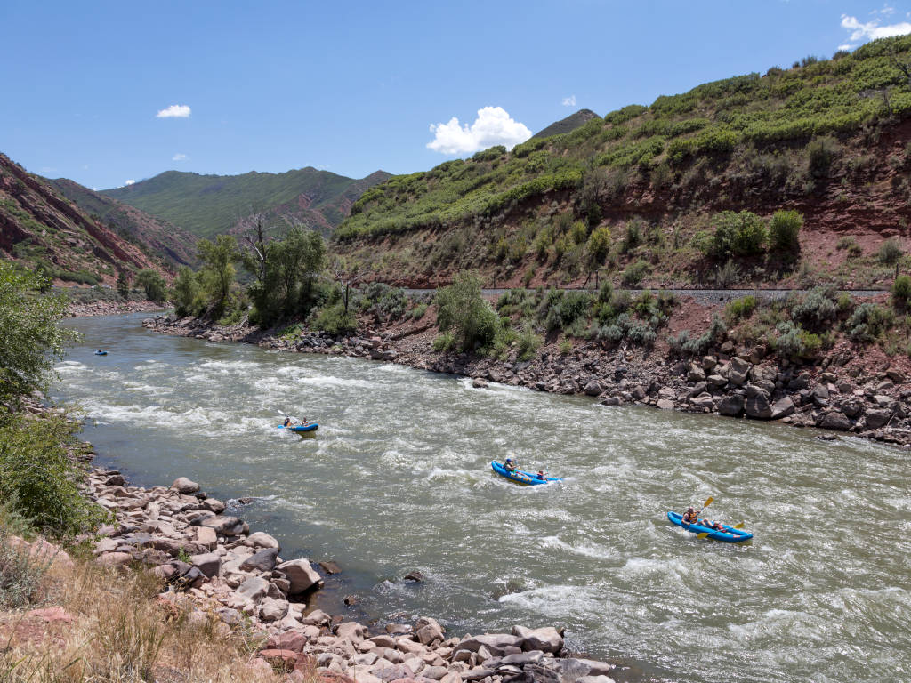
Rafting & Kayaking in Glenwood Canyon
The Colorado River is a popular spot for rafting and kayaking. Several ramps in & out of the Colorado River were built as part of the Glenwood Canyon interstate highway construction project. Check with the guides below for deals on river adventures in Glenwood Canyon.
Whitewater Rafting LLC
Choose from multiple options of difficulty and length including half-day and full-day rafting adventures down the Colorado River.
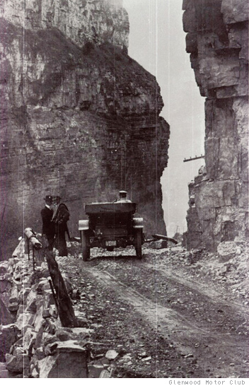
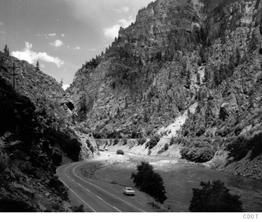
US Highway 6 ran through Glenwood Canyon long before there was an interstate here. As traffic increased, the two-lane highway was no longer sufficient and a massive project was proposed to solve this. The Glenwood Canyon portion of the interstate was the last part of I-70 to be finished in Colorado. Construction began in 1981 and continued until 1992.
The photo below shows the first roadway through the canyon in 1903.
The initial dirt roadway was eventually replaced during the 1930s by US 6, a two-lane highway.
No, however, the Mighty Colorado does become a lot mightier here. The Eagle River joins the Colorado River just to the west of Glenwood Springs, and the Roaring Fork River joins from the Aspen area right at Glenwood springs.