Spring Creek Pass
As the Continental Divide heads south through Colorado, it is intersected by Colorado HWY 149 on Spring Creek Pass before winding towards Wolf Creek Pass.
This pass is located in the San Juan Mountain Range, and it is one of the last mountain passes over the divide on the way south before it hits the New Mexico border. Mountain peaks that surround this mountain pass include: Black Mountain, Table Mountain and Baldy Cinco.
Spring Creek Pass is a part of Colorado’s Silver Thread Scenic Byway.
Seasonal Info
Spring Creek Pass is open year-round.
Spring Creek Pass Stats
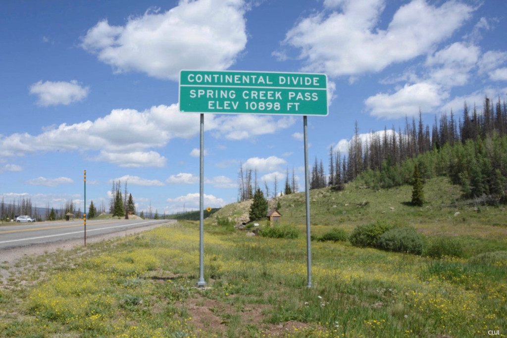
- Road Elevation: 10,898'
- Surface: Paved
- Mountain Range: San Juan Mountains
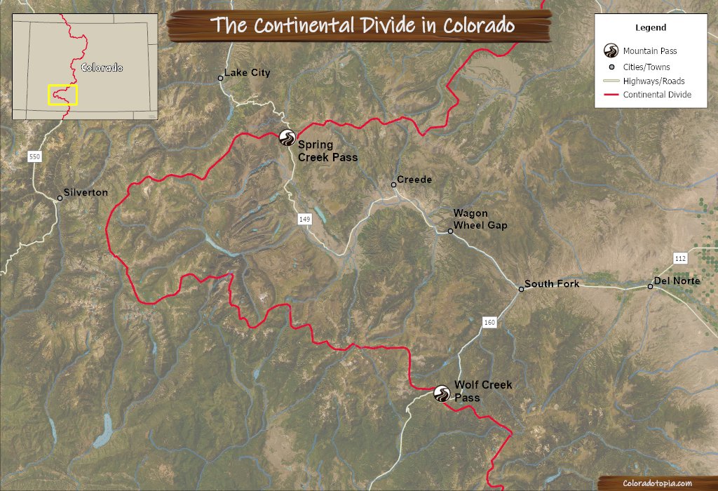
The red line in the map below represents the Continental Divide. The next closest paved road over the divide to the south is Wolf Creek Pass. The next closest road to the north over the divide is North Pass/North Cochetopa Pass.
Sitting at almost 11k feet in altitude, the top of this pass on the Continental Divide represents a place where the rivers will either flow into the Rio Grande Basin and then eventually to the Gulf of Mexico, or they flow into the Colorado River Basin, eventually winding up in the Pacific Ocean.
Slumgullion Pass is located just to the north of Spring Creek Pass on the same highway. The Slumgullion Earthflow shown in the photo below is an active earthflow area where the ground is still slowly sliding each year.
Water Diversion on Spring Creek Pass
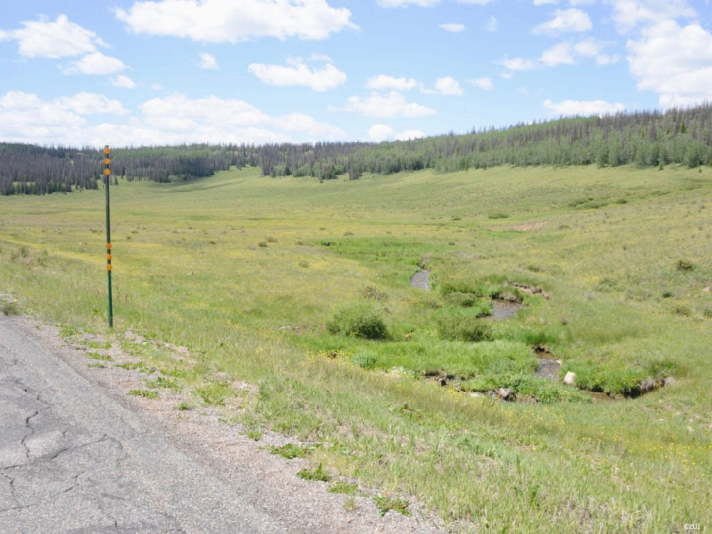
Like the rest of the Continental Divide, the water flow here does not exactly follow the natural order. Water diversion efforts on this pass are smaller than what you’ll find on the passes that are closer to the Front Range. Still, humans have been diverting water across the divide on Spring Creek Pass for more than 100 years in order to meet our needs.
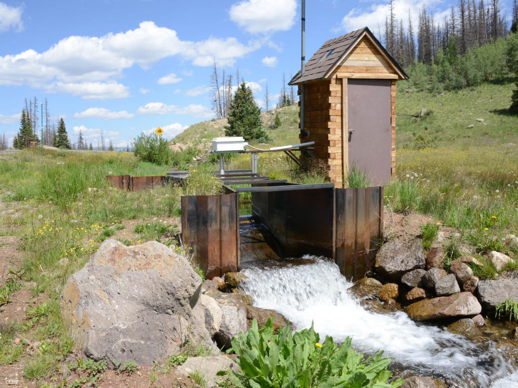
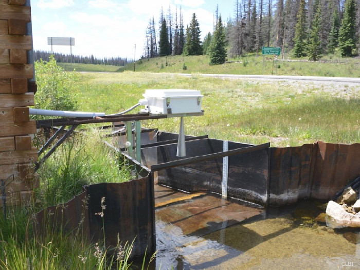
The Tabor Ditch can be seen in the photo above as it flows next to the top of Spring Creek Pass. This ditch moves water from the tributaries of Cebolla Creek (Gunnison Basin) to Spring Creek, which is a tributary of North Clear Creek (Rio Grande Basin). This ditch was originally built just for irrigation, but the purpose has been expanded to include wildlife habitat management and reservoir conservation pool management.
This ditch is just under 1/2 mile long, and it measures approximately 5 feet across and 3 feet deep. The estimated water flow capacity is 30 cu. ft./s.¹ You can see a Parshall flume with wooden housing in the stream. This is used to measure the flow of water through the irrigation ditch.
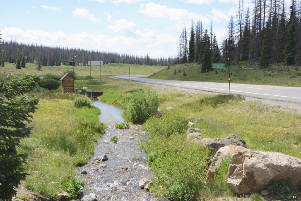
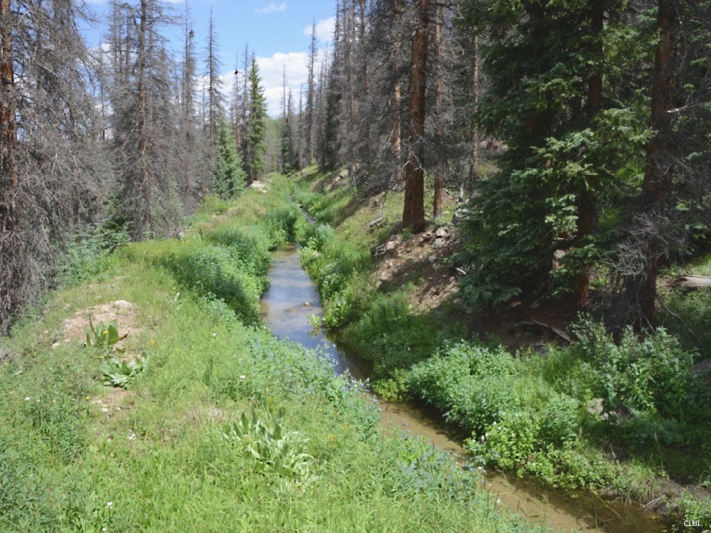
Just a short distance down the southern side of the pass, the water goes through a culvert and forms Spring Creek. This flows into North Clear Creek, and then into the Santa Maria Reservoir. This reservoir primarily serves the San Luis Valley.
Alternate Routes – There are no great alternate routes for Spring Creek Pass through this part of the state. If you need a paved road during the winter, the next closest route to the west is US HWY 550. To the east, the closest alternate route would be HWY 285 + HWY 114.
Recreation on Spring Creek Pass
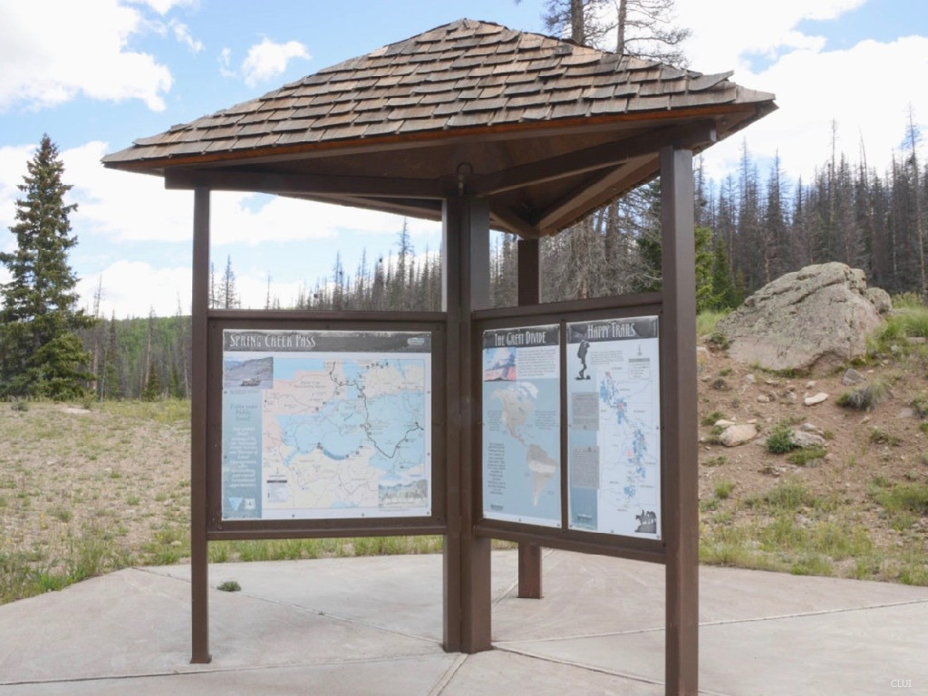
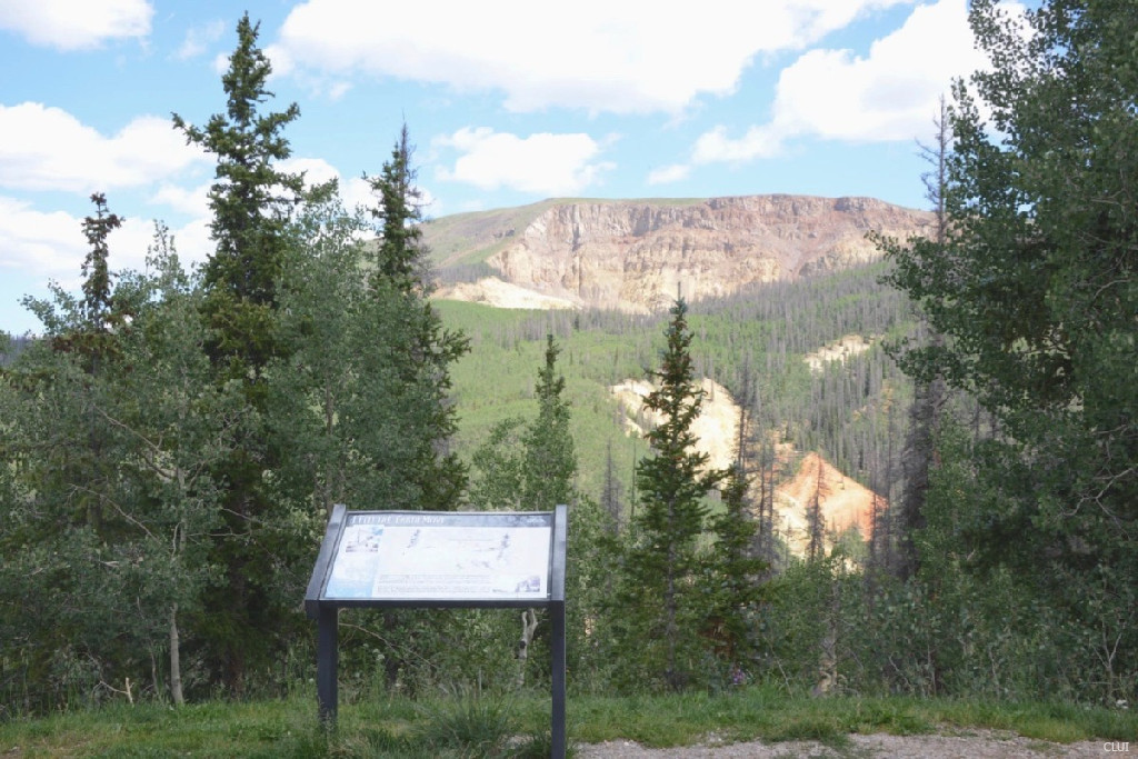
Spring Creek Pass is traversed by two popular trails sharing the same route: the Colorado Trail and the Continental Divide Trail. The trailhead can be seen in the photo above. This is Segment 22 of the Colorado Trail, and the trailhead is located just off of the highway at the top of the pass. The Spring Creek Campground is located just beyond this parking area.
Spring Creek Pass FAQ
Spring Creek Pass is located in SW Colorado, in the San Juan Mountains, to the east of Silverton, and to the north of Wolf Creek Pass. This is in Hinsdale County.
There is an outback restroom at the campground for campers, but that’s it.
Yes, Spring Creek Pass is open year-round and does not close for the winter season.
Spring Creek Pass History
Water from the Tabor Ditch was appropriated in 1910.1
Just like almost all the other mountain passes over the Continental Divide in Colorado, a wagon road existed here before any modern road was built for cars. A venture called the Creed and Gunnison Short Line Railway was incorporated in 1893 because it was thought that building a railroad would be cheaper than paying to have ore hauled by wagon. Teamsters were charging between $1.50 and $2.50 per ton to haul ore through this area at the time.2 This was one of hundreds, or possibly thousands of railroads that were proposed but never actually built during this time period in Colorado.
US Highway 129 was established administratively in 1923, along with the establishment of Colorado’s numbered highway system. The modernized road over the pass was built in the coming years.4
This was a gravel road during most of the 1900s, and it was closed during the winters. The highway was paved by the year 1983.4
References & Credits
1. John N. Winchester, A Historical View: Transmountain Development in Colorado, 2000, retrieved January, 4, 2024. View.
2. The Rocky Mountain News (Daily), Volume 34, February 17, 1893, p. 2. Colorado Historic Newspapers Collection. Colorado State Library.
3. Wikimedia Foundation (2023, December 8). List of state highways in Colorado. Wikipedia. https://en.wikipedia.org/wiki/List_of_state_highways_in_Colorado. Accessed January 6, 2024.
4. Silver thread scenic & historic byway. Silver Thread Scenic & Historic Byway. (2019, October 11). https://silverthreadbyway.com/
Images Credits: Center for Land Use Interpretation | More info