Wolf Creek Pass crosses the Continental Divide in Colorado between South Fork and Pagosa Springs. Drivers can expect a 7% grade on the western side of the pass at the steepest points, and less on eastern side. This pass is traversed by HWY 160 as it travels by the Wolf Creek Ski Area.
The beginning portions of the route between Pagosa Springs and South Fork are relatively tame on both sides. Once you are within 10 miles of the summit on either side of the pass, the highway will start to get steeper.
Seasonal Info
Wolf Creek Pass is open year-round with temporary closures for weather or accidents.
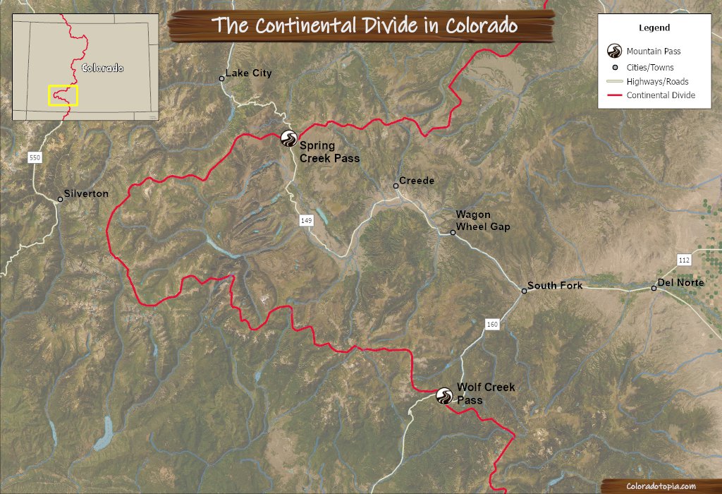
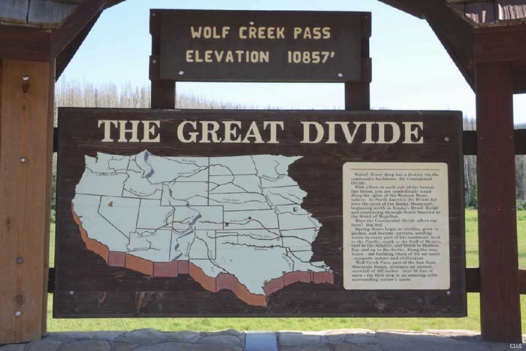
The map below shows the path of the Continental Divide as it runs through SW Colorado. Spring Creek Pass and Wolf Creek Pass are the last 2 paved roadways to cross the Continental Divide before it hits the New Mexico border.
Alternate Routes – There are no immediate alternate routes to HWY 160 over Wolf Creek Pass. If the pass is closed for weather and you need to get around, you can go through Monte Vista to get to CO Highway 17.
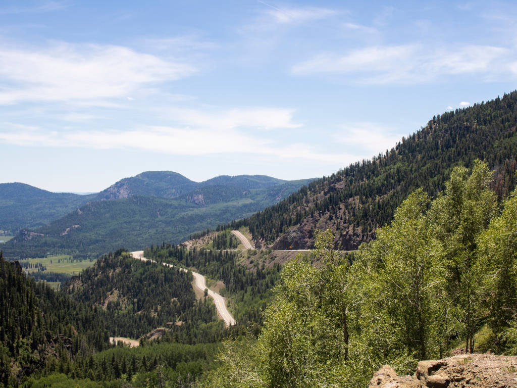
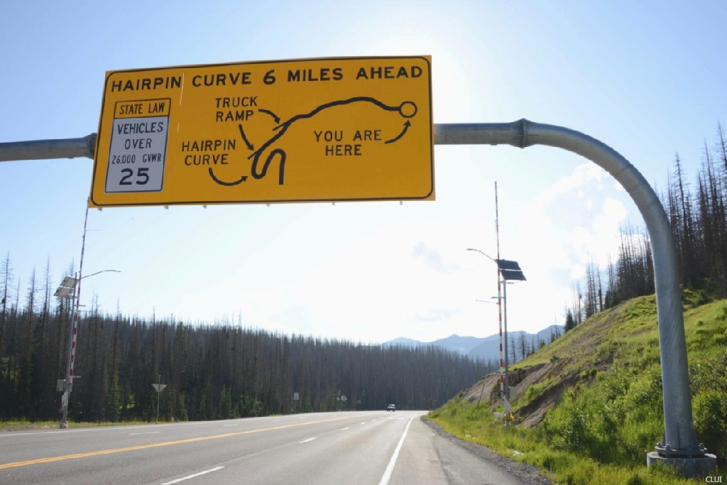
A runaway truck ramp can be seen above the switchback in the photo below. This area is on the western side of the pass, and this is one of the most picturesque parts of the drive over the pass.
Switchback on the western side of Wolf Creek Pass
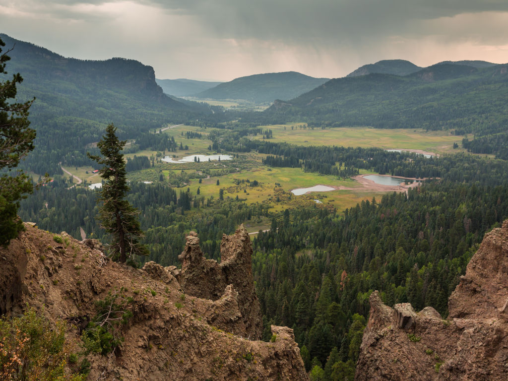
The overlook that you see in the photo below is located on the switchback that you see in the photo above. This view looks westward from the pass. Pagosa Springs is about a 17-mile drive from here.
Overlook on west side of Wolf Creek Pass
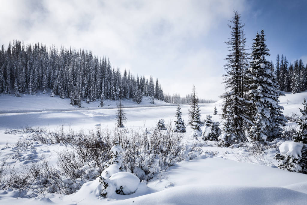
Winter on the pass
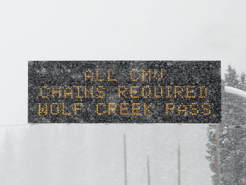
Chains may be required for commercial vehicles, but not passenger vehicles
Starting the descent down the western side of the pass just beyond the summit parking lot
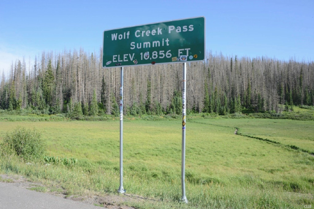
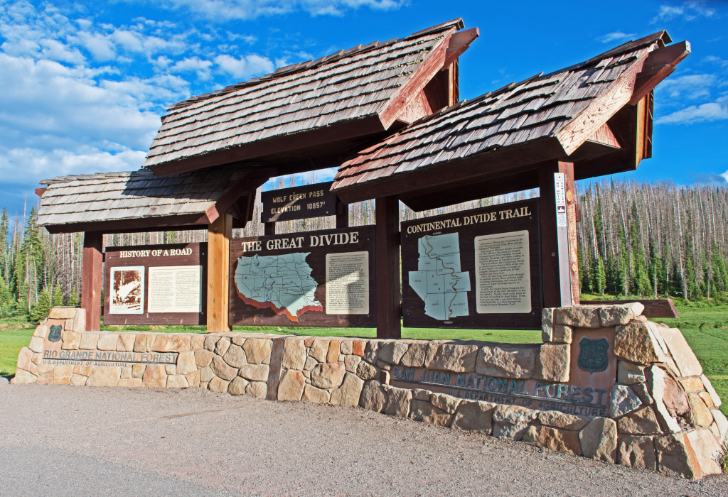
Summit Sign at the top of Wolf Creek Pass
Nearby the green road sign at the top of the pass
Hiking on Wolf Creek Pass
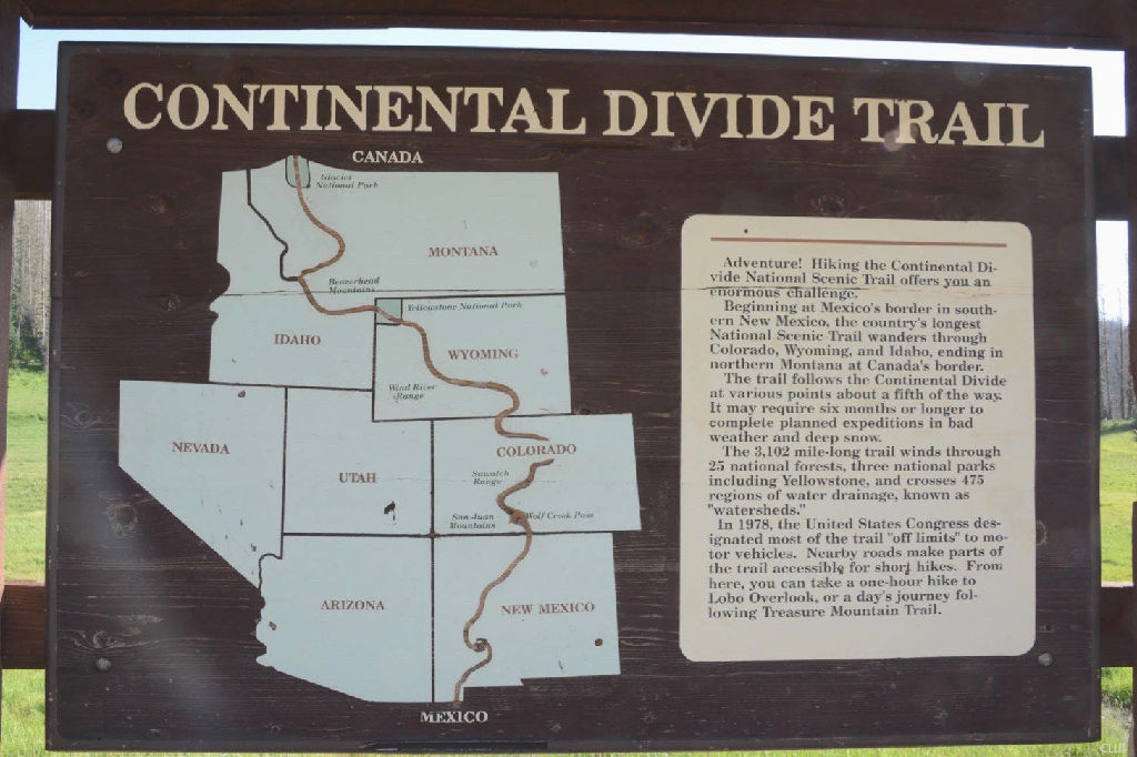
The photo below shows the Continental Divide Trail sign at the summit of Wolf Creek Pass. This hiking trail runs the full length of the Continental Divide through the United States, stopping just a short distance from the US-Mexico border.
What else can you do on Wolf Creek Pass? There is parking on the roadside at the top of the pass, and a parking lot just down the road where the turnoff for the Lobo Overlook is located. You can access the Wolf Creek Pass Trailhead from there, and this is where you’ll find the Wolf Creek Pass Winter Use Area. This is prime territory for cross-country skiers, backcountry skiers, snowmobilers, and sledders.
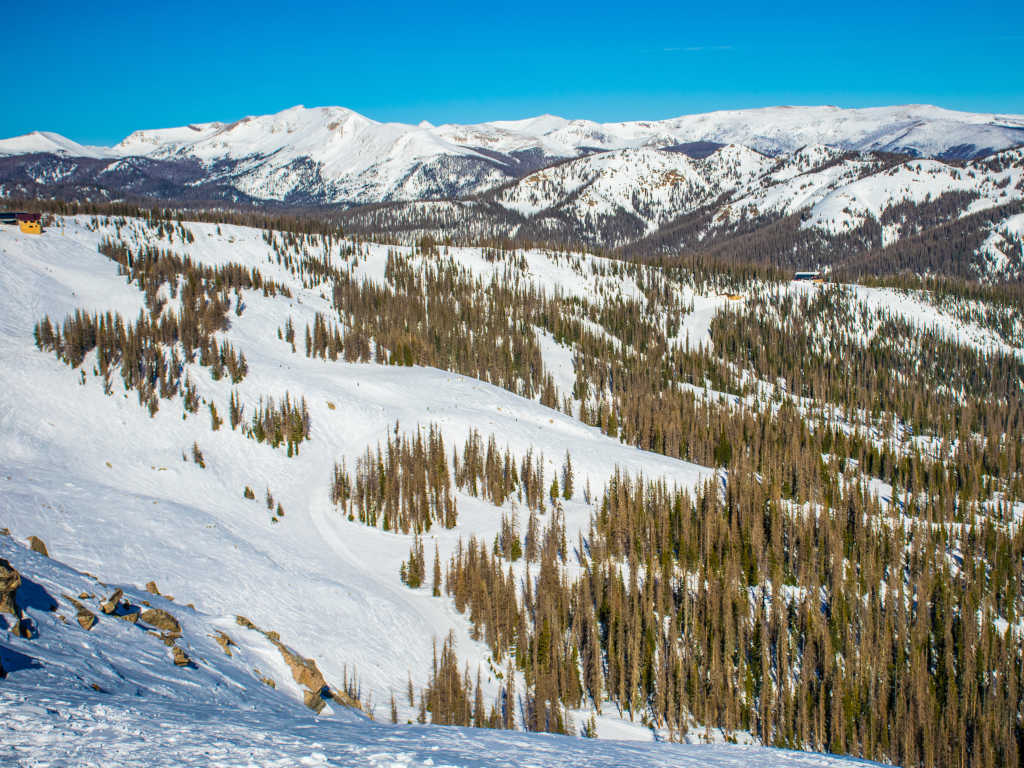
Wolf Creek Ski Area
The Wolf Creek Ski Area is well-known for its deep powder skiing. The ski area is located right on Wolf Creek Pass, making it one of 4 ski areas in Colorado that are located directly on the Continental Divide.
There are no facilities near the roadway at the summit of Wolf Creek Pass. The summit where the pass crosses the Continental Divide has a wide pull-out area near the signs that you see on this page.
There will be temporary closures during the winter for snowstorms and accidents, but the pass does not close for the winter season. There are closure gates located 10 miles from the summit on the eastern side. The closure gates on the western side are just under 8 miles from the summit.
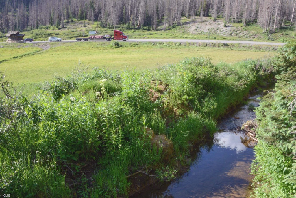
The pass from Pagosa Springs to South Fork on US 160 measures just over 41 miles. About half of this route is relatively flat. The more dramatic part of the pass starts about 8-10 miles from the summit on each side.
The steepest parts will be 45 mph for cars, with a short portion being 35 mph. Trucks over 26,000 GWVR are limited to 25 mph while descending on the western side. That limitation is not needed on the eastern side.
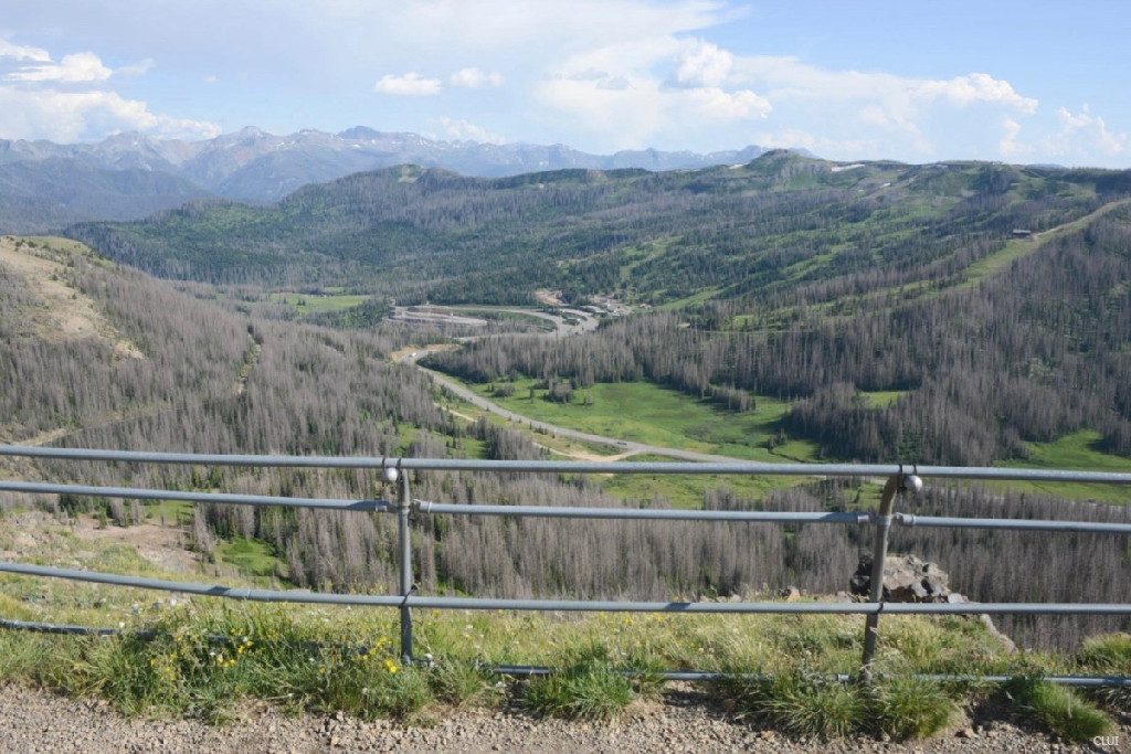
The Lobo Overlook
The Lobo Overlook sits on top of a dirt road that branches off from Wolf Creek Pass near the road’s summit. You can see the Wolf Creek Ski Area just across the highway while looking to the southeast from the overlook.
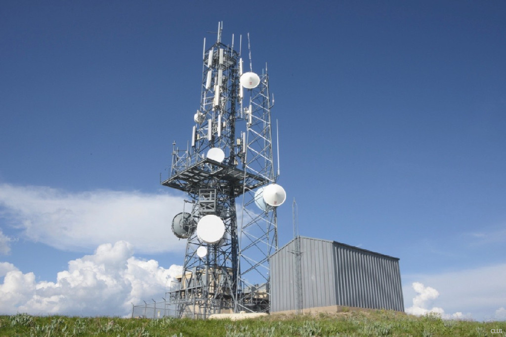
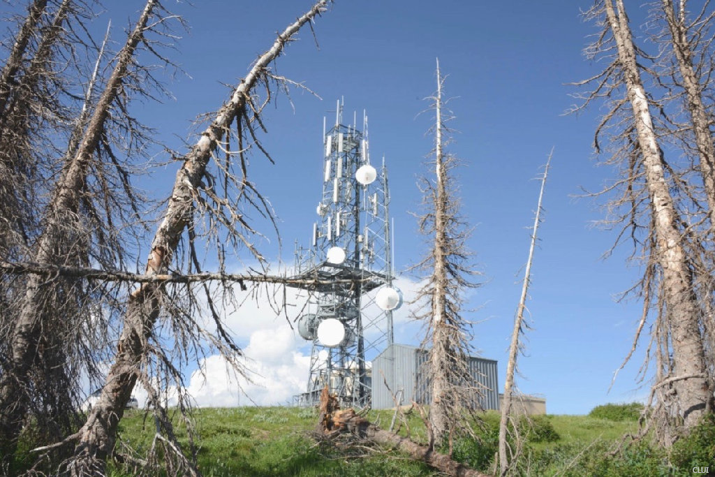
You’ll find the telemetry tower antennas in the photos below located right behind the overlook seen above.
Directions from Denver
Expect the drive from Denver to Wolf Creek Pass to take about 4.5 hours. The directions are fairly simple. Just take CO HWY 285 south until you hit HWY 112. Head west for a short time until it intersects with HWY 160. Head west from there until you hit Wolf Creek Pass.
US HWY 285 South
CO HWY 112 West
US HWY 160 West
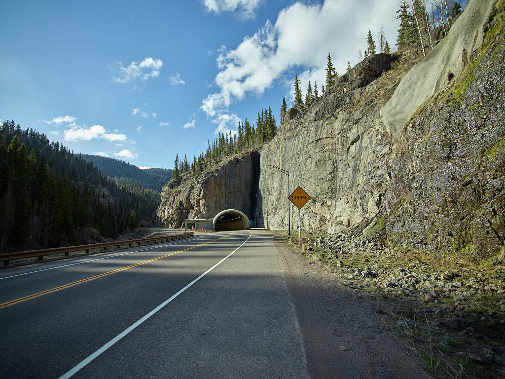
Did You Know?
The tunnel on Wolf Creek Pass is monitored from a CDOT station in Glenwood Canyon. There is a command center that is located underground inside of the tunnel, near the Hanging Lake exit. This facility was primarily built to monitor and control operations in Glenwood Canyon, but now also serves as the command center for CDOT operations on the Western Slope.
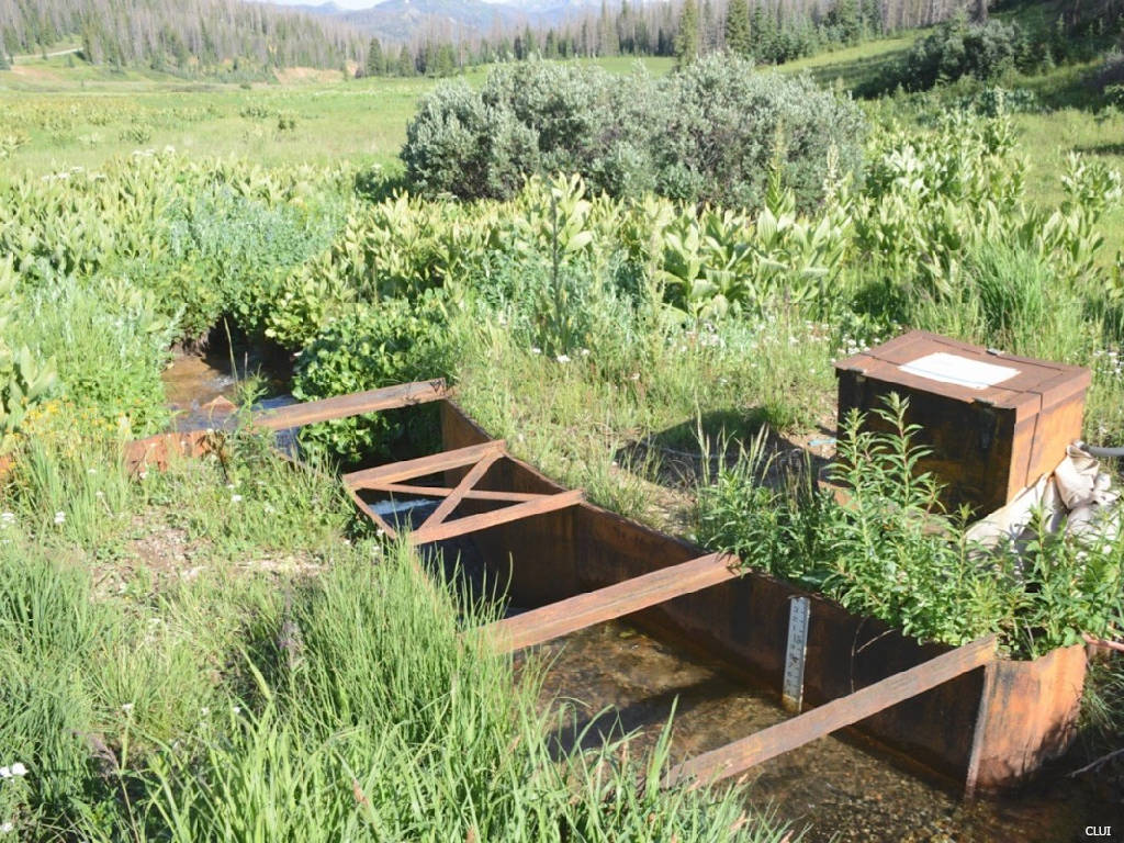
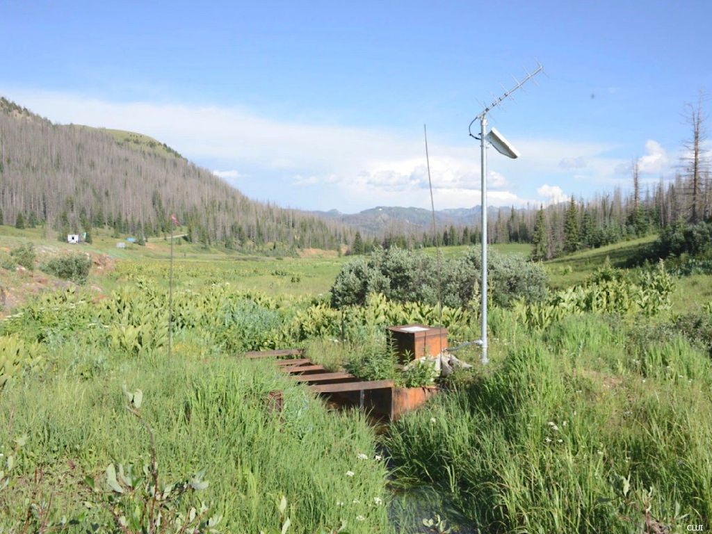
Water Diversion on Wolf Creek Pass
The Treasure Pass Diversion Ditch carries approximately 125 acre-feet of water per year across the divide from the western side. That’s enough to fill about 62 Olympic-sized swimming pools. The water goes to irrigate the San Luis Valley on the eastern side of the Continental Divide.
The water flow is measured through a Parshall flume on top of the pass. This water-monitoring station is located just off of the roadway, near the summit on the northern side of the highway. You can still see HWY 112 on the left of the 2 photos above.
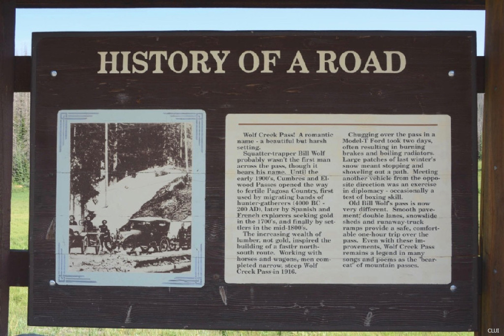
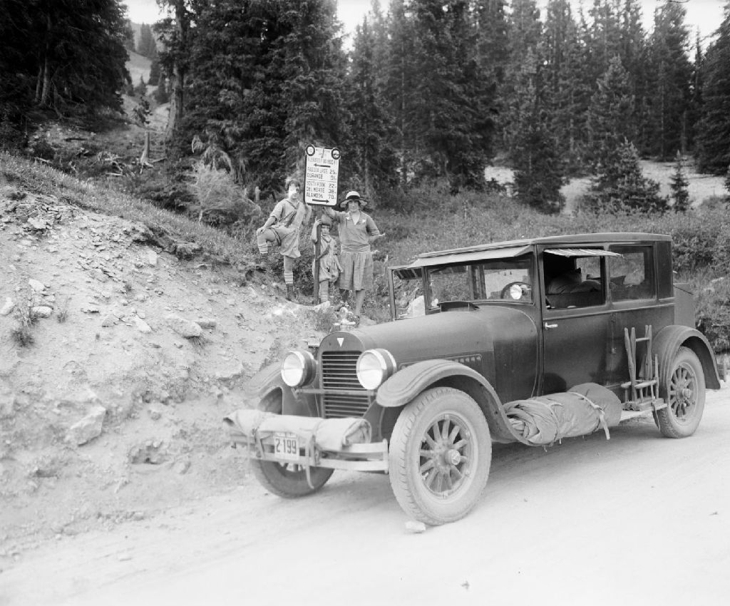
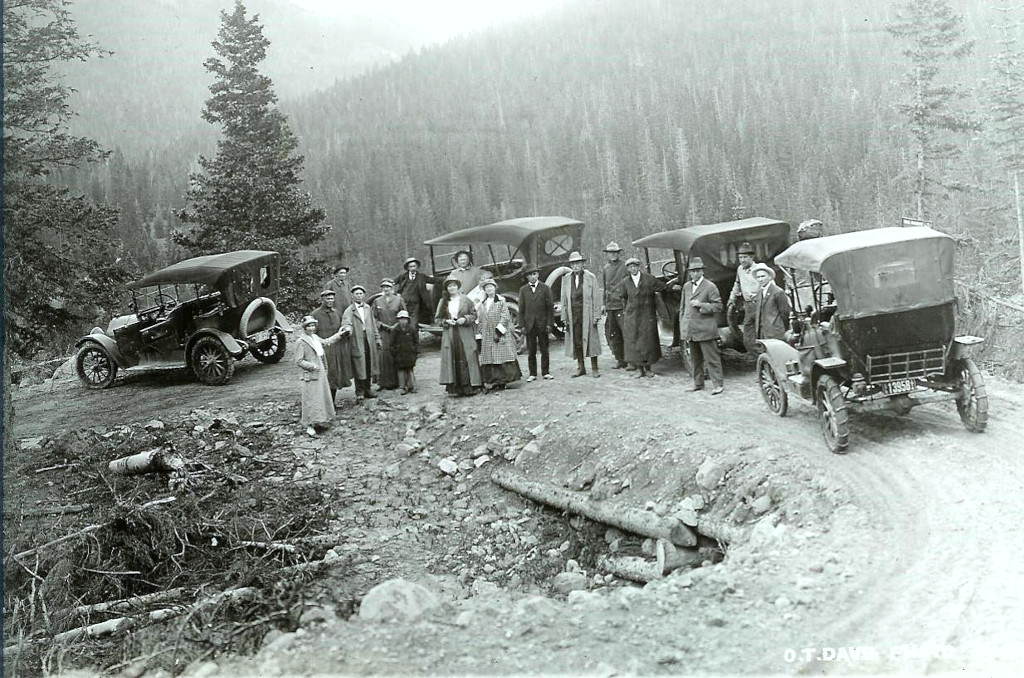
Work began on the pass in 1914.1 An opening ceremony took place on August 21st, 1916, when the pass officially opened for the first time.2, 3 The road was nearly completed in the fall of 1915, with about 10 days of work left to be done, but a winter storm moved in and halted construction for the season.4 The cost of road construction was approx. $5,000 per mile.5 The road was 12-feet wide and unpaved when it opened in the spring.
Excavation work on the pass started in 1922 to widen a portion of the road to 20 feet.6 This work continued to at least 1924. It would be widened again in 1930, and paved in 1950.7
The pass was not always opened year-round. Newspaper articles from the 1930s detail how the pass was still getting ready to be opened in the months of June and July. In January 1937, it was reported that the State Highway Department sent a rotary snow plow to Wolf Creek Pass in order to try and keep it open for the winter. A similar plow was also sent to Tennessee Pass that same year because they had decided to try to keep that pass open year-round as well.8 This was also the same winter that Rabbit Ears Pass was able to stay open for the first time through the winter. In that case, a rotary snowplow was sent over from Berthoud Pass.
The pass would stay open in the winter of 1936-’37, with a few occasions when the pass closed for 1-2 days during storms.
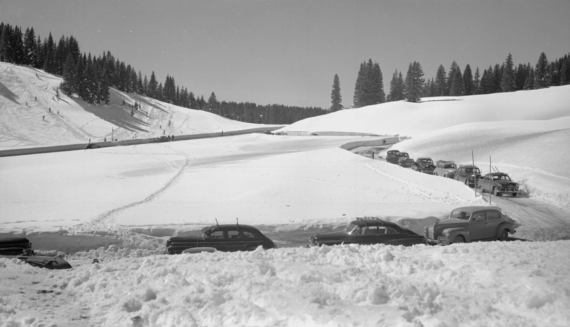
Above: Highway 160, Wolf Creek Ski Area and parking, 1950. View full size photo.
1. The Bayfield Blade, August 28, 1914, p. 1. Colorado Historic Newspapers Collection. Colorado State Library.
2. The San Juan Prospector, August 19, 1916, p. 4. Colorado Historic Newspapers Collection. Colorado State Library.
3. Alamosa Journal, August 24, 1916, p. 8. Colorado Historic Newspapers Collection. Colorado State Library.
4. The San Juan Prospector, April 8, 1916, p. 2, Colorado Historic Newspapers Collection. Colorado State Library.
5. The Alamosa Courier, Volume XXVII, Number 34, October 23, 1915, p. 8. Colorado Historic Newspapers Collection. Colorado State Library.
6. Montrose Daily Press, Volume XV, Number 153, January 2, 1924, p. 5. Colorado Historic Newspapers Collection. Colorado State Library.
7. Wolf Creek Pass turned 103 this year. Oct 3, 2019. Del Norte Prospector. Retrieved January 1, 2024, from https://delnorteprospector.com/article/wolf-creek-pass-turned-103-this-year
8. The Holy Cross Trail, Volume 27, Number 4, January 22, 1937, p. 1. Colorado Historic Newspapers Collection. Colorado State Library.
